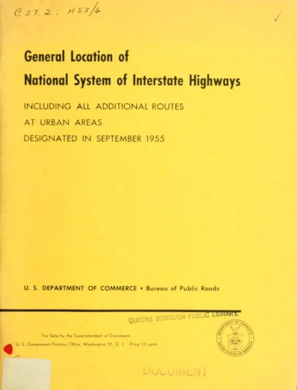
The Yellow Book, 1955
The Yellow Book is a nickname given to the General Location of National System of Interstate Highways. This book was used as an outline for where interstates were to be built in every city with a population of over 50,000 people in the United States - 104 cities in total. I am photographing each of these cities to create a survey of the consequences of the interstate highway system. Many cities used them to reinstate racial divides after desegregation, many built them directly through thriving Black communities. Some cities successfully stopped the building of highways to protect their parks. Others have now gentrified becoming sought-out neighborhoods due to close proximities to downtowns. Please click the icon in the bottom right corner to read the history of what happened in the location of each photograph, and please check back regularly as I continue to photograph across the United States.
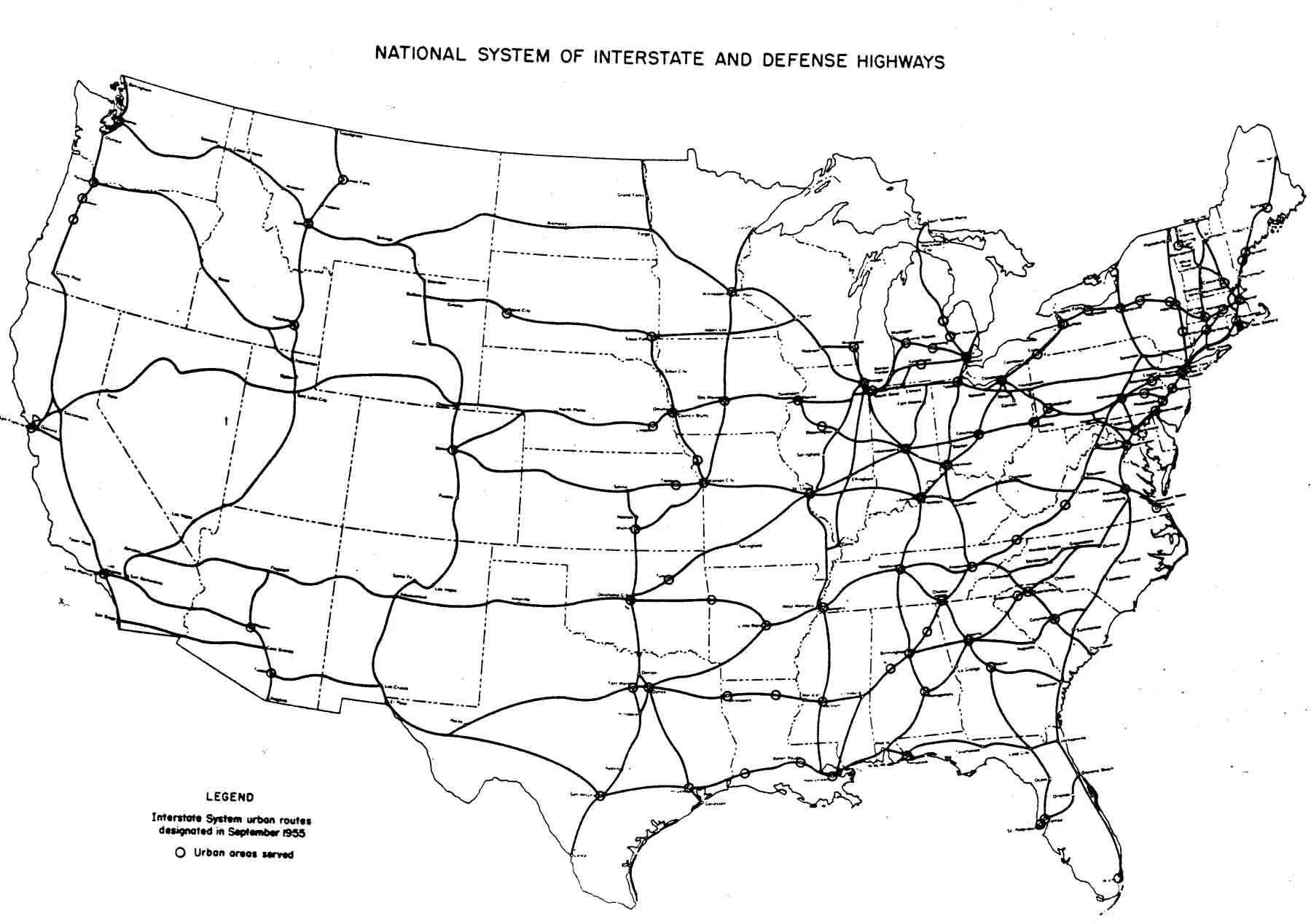
National System of Interstate and Defense Highways, 1955

1955 Birmingham, AL

Birmingham, AL
Archival Pigment Print, 32x40”, 2021
Birmingham is one of the worst offenders of how it used the highway. Interstate 59 was built along 11th avenue, a route that precisely mirrored the racial zoning boundary that was included in the old racial zoning ordinance. It divided the white and black communities.

Birmingham, AL
Archival Pigment Print, 32x40”, 2021
Interstate 65 in Birmingham was used in the same way, following the boundaries drawn on racial zoning maps.

Birmingham, AL
Archival Pigment Print, 32x40”, 2021

Birmingham, AL
Archival Pigment Print, 32x40”, 2021

Birmingham, AL
Archival Pigment Print, 32x40”, 2021
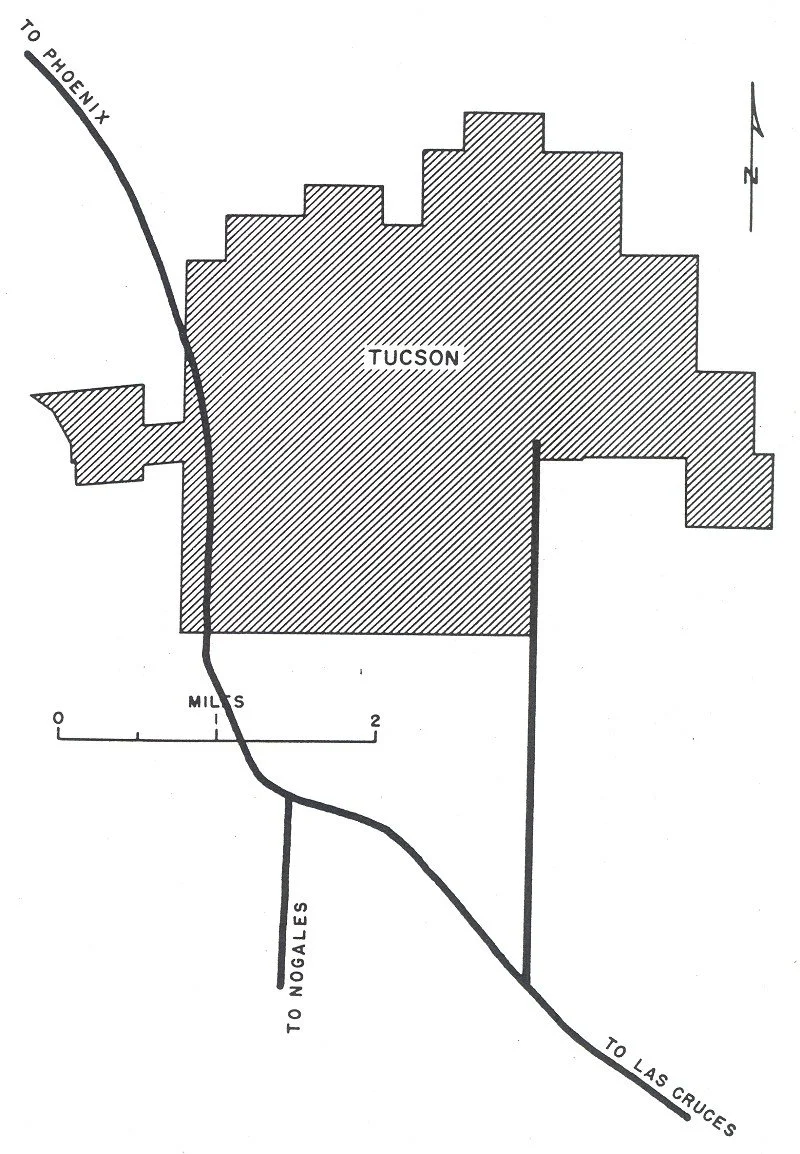

Tuscon, Arizona
Archival Pigment Print, 32x40”, 2022

Tucson, Arizona
Archival Pigment Print, 32x40”, 2022

Tuscon, Arizona
Archival Pigment Print, 32x40”, 2022

Tucson, Arizona
Archival Pigment Print, 32x40”, 2022
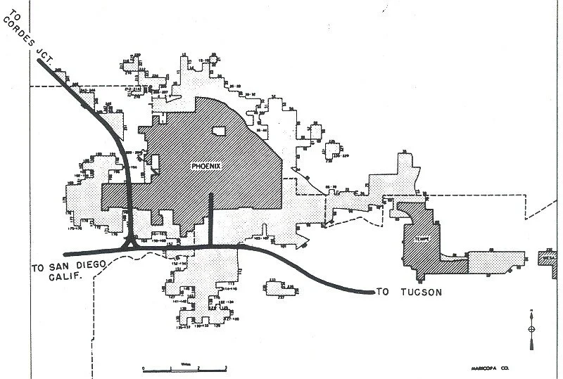

Phoenix, Arizona
Archival Pigment Print, 32x40”, 2022
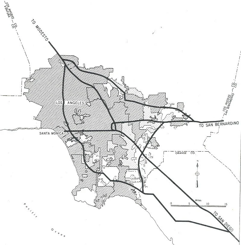

Los Angeles, California
Archival Pigment Print, 31x40”, 2022
In the 1950s the 101 Freeway was built through the Latino community of Boyle Heights, plowing 6 lanes of traffic through this neighborhood.
Source: https://www.latimes.com/projects/us-freeway-highway-expansion-black-latino-communities/

Los Angeles, California
Archival Pigment Print, 31x40”, 2022
I-10 West, which traverses from the east coast of Florida to the West coast of California, dead ends into the Santa Monica Pier, stretching 2460 miles.

Los Angeles, California
Archival Pigment Print, 32x40”, 2022


San Francisco, California
Archival Pigment Print, 32x40”, 2022

San Francisco, California
Archival Pigment Print, 32x40”, 2022

San Francisco, California
Archival Pigment Print, 32x40”, 2022

Oakland, California
Archival Pigment Print, 31x40”, 2022
In West Oakland, African American and Latino communities were displaced by the construction of the Nimitz Freeway (or I-880) and urban renewal which installed the BART system and main post office.
Source: https://www.oaklandca.gov/topics/oaklands-history-of-resistance-to-racism

Oakland, California
Archival Pigment Print, 32x40”, 2022


Denver, Colorado
Archival Pigment Print, 32x40”, 2022
https://www.hcn.org/issues/47.22/in-denvers-latino-neighborhoods-a-fight-against-bigger-highways

Denver, Colorado
Archival Pigment Print, 32x40”, 2022
https://www.hcn.org/issues/47.22/in-denvers-latino-neighborhoods-a-fight-against-bigger-highways

Denver, Colorado
Archival Pigment Print, 32x40”, 2022
https://www.hcn.org/issues/47.22/in-denvers-latino-neighborhoods-a-fight-against-bigger-highways

Denver, Colorado
Archival Pigment Print, 32x40”, 2022
https://www.hcn.org/issues/47.22/in-denvers-latino-neighborhoods-a-fight-against-bigger-highways

Denver, Colorado
Archival Pigment Print, 32x40”, 2022
https://www.hcn.org/issues/47.22/in-denvers-latino-neighborhoods-a-fight-against-bigger-highways
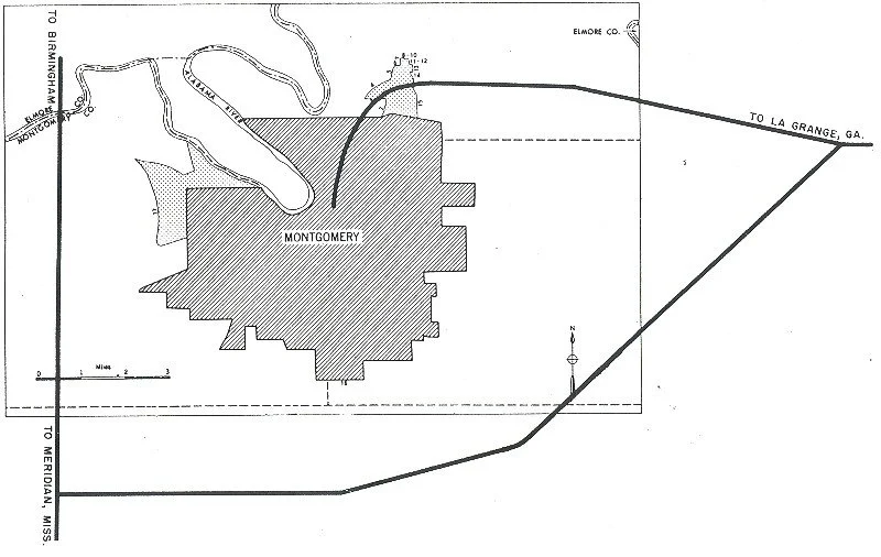
1955 Montgomery, AL

South Holt Street Community, Montgomery, AL
Archival Pigment Print, 32x40”, 2020
In Montgomery AL, the block of South Holt Street, beneath interstates I-65 and I-85 was once a thriving African American community. As census data shows, it is always the poorest neighborhoods that are next to the interstates.

Montgomery, AL
Archival Pigment Print
32x40”
2020

Montgomery, AL
Archival Pigment Print
32x40”
2020
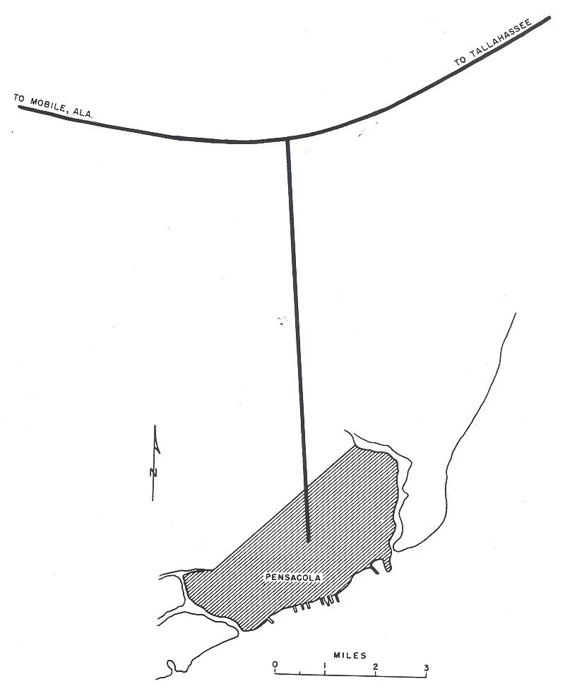
1955 Pensacola, FL

The Lost Community, Pensacola, FL
Archival Pigment Print, 32x40”, 2021
The YMCA Cecil T Hunter pool sits under intestate 110, in a part of town called ”the lost community” Pensacola Florida. It too was a successful black neighborhood.
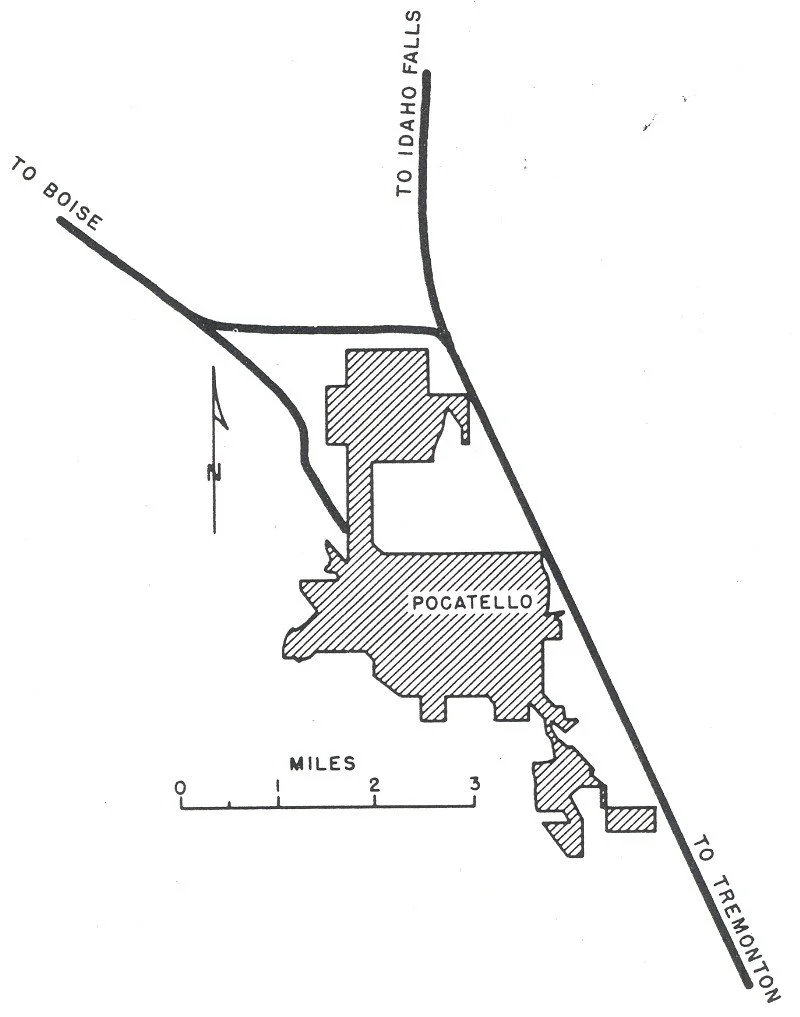

Pocatello, Idaho
Archival Pigment Print, 32x40”, 2022

Pocatello, Idaho
Archival Pigment Print, 32x40”, 2022
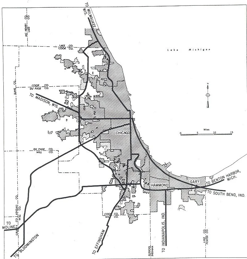

Chicago, Illinois
Archival Pigment Print, 32x40”, 2022

Chicago, Illinois
Archival Pigment Print, 32x40”, 2022
https://abc7chicago.com/pilsen-chicago-history-neighborhood-gentrification/12312130/

Chicago, Illinois
Archival Pigment Print, 32x40”, 2022
https://abc7chicago.com/pilsen-chicago-history-neighborhood-gentrification/12312130/
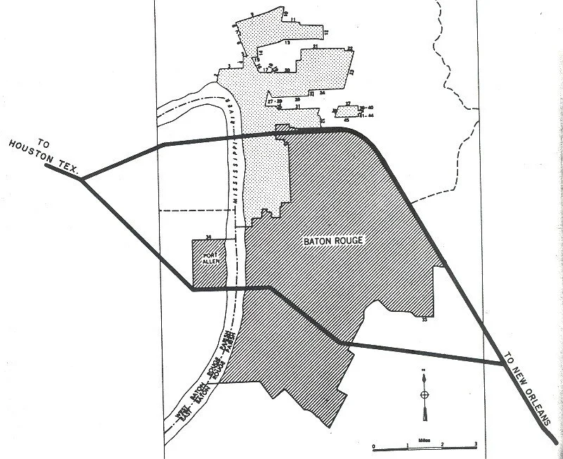
1955 Baton Rouge, LA

Old South Baton Rouge, LA
Archival Pigment Print, 32x40”, 2021

1955 Shreveport, LA

Shreveport, LA
Archival Pigment Print, 32x40”, 2021
This photograph was made from Laurel Street, underneath looking through the houses towards interstate 20. There are current proposals to build the I-49 connector through the historic black community of Allendale. Allendale Strong is a neighborhood group working to stop the plans.
https://allendalestrong.org/the-latest-news-updates/
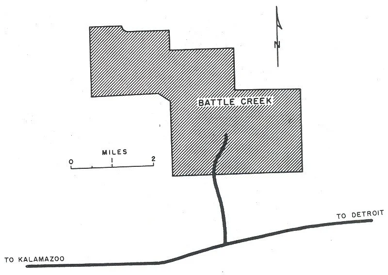


The Sojourner Truth Downtown Parkway
https://www.battlecreekenquirer.com/story/news/2021/01/24/why-people-battle-creek-refer-interstate-194-the-penetrator/4211738001/


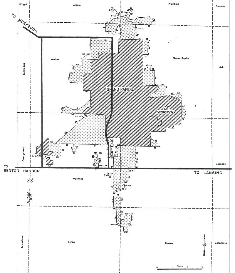


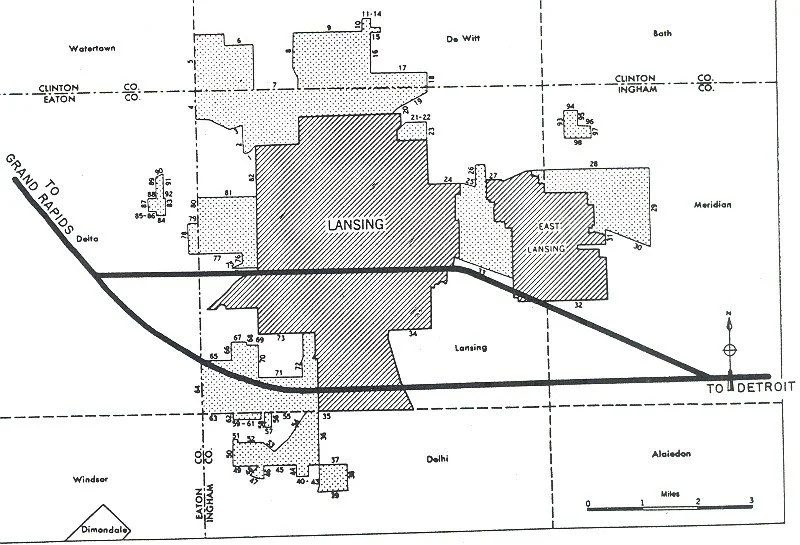

Lansing, Michigan
https://lansinghistory.blogspot.com/p/paving-way-i-496.html


Minnesota, Minneapolis
Archival Pigment Print, 32x40”, 2022

The Rondo, St.Paul, Minnesota
Archival Pigment Print, 32x40”, 2022

The Rondo, Minnesota, Minneapolis
Archival Pigment Print, 32x40”, 2022
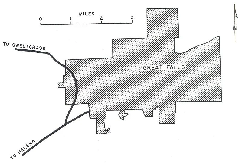

Great Falls, Montana
Archival Pigment Print, 32x40”, 2022
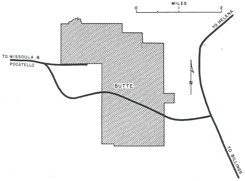

Butte, Montana
Archival Pigment Print, 32x40”, 2022

Butte, Montana
Archival Pigment Print, 32x40”, 2022

Butte, Montana
Archival Pigment Print, 32x40”, 2022

Butte, Montana
Archival Pigment Print, 32x40”, 2022
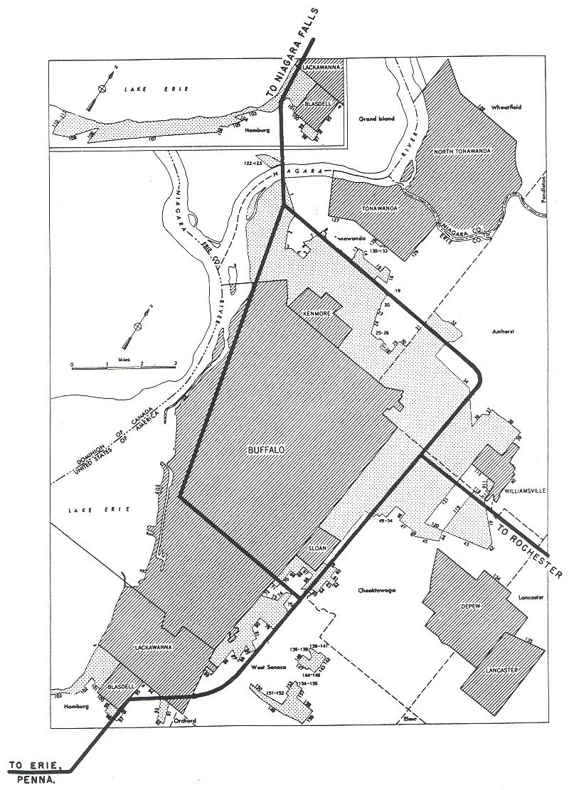

Humboldt Parkway, Buffalo NY
https://www.wbfo.org/local/2018-01-15/expressway-seen-as-symbol-of-racial-inequity-health-problems

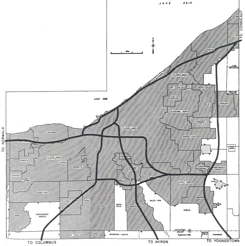

Cleveland, Ohio
Archival Pigment Print, 32x40”, 2022

Shaker Heights, Cleveland, Ohio
Archival Pigment Print, 32x40”, 2022

Cleveland, Ohio
Archival Pigment Print, 32x40”, 2022

Cleveland, Ohio
Archival Pigment Print, 32x40”, 2022
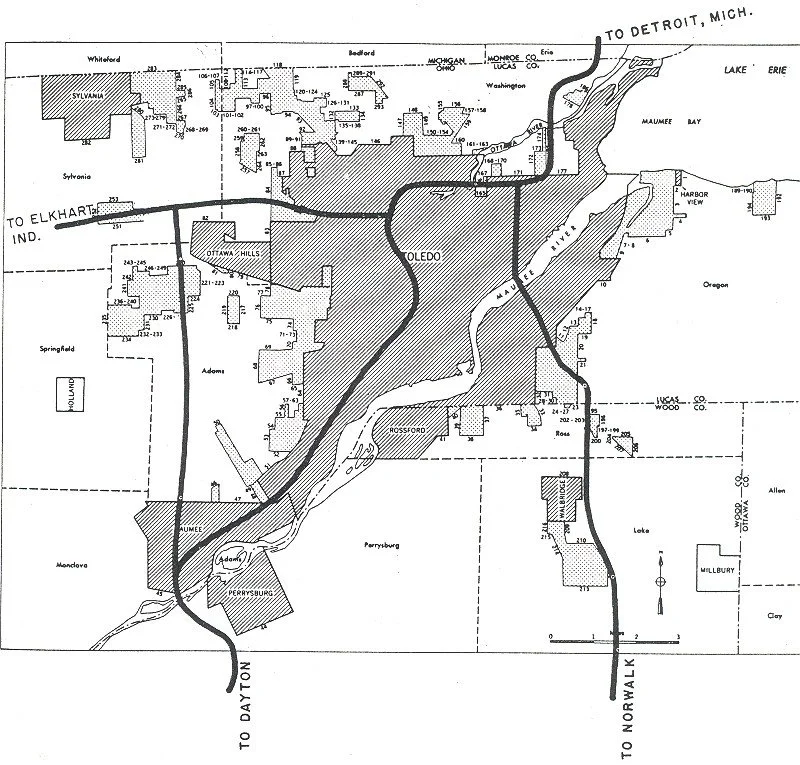

Toledo, Ohio
Archival Pigment Print, 32x40”, 2022

Toledo, Ohio
Archival Pigment Print, 32x40”, 2022

Toledo, Ohio
Archival Pigment Print, 32x40”, 2022

Toledo, Ohio
Archival Pigment Print, 32x40”, 2022
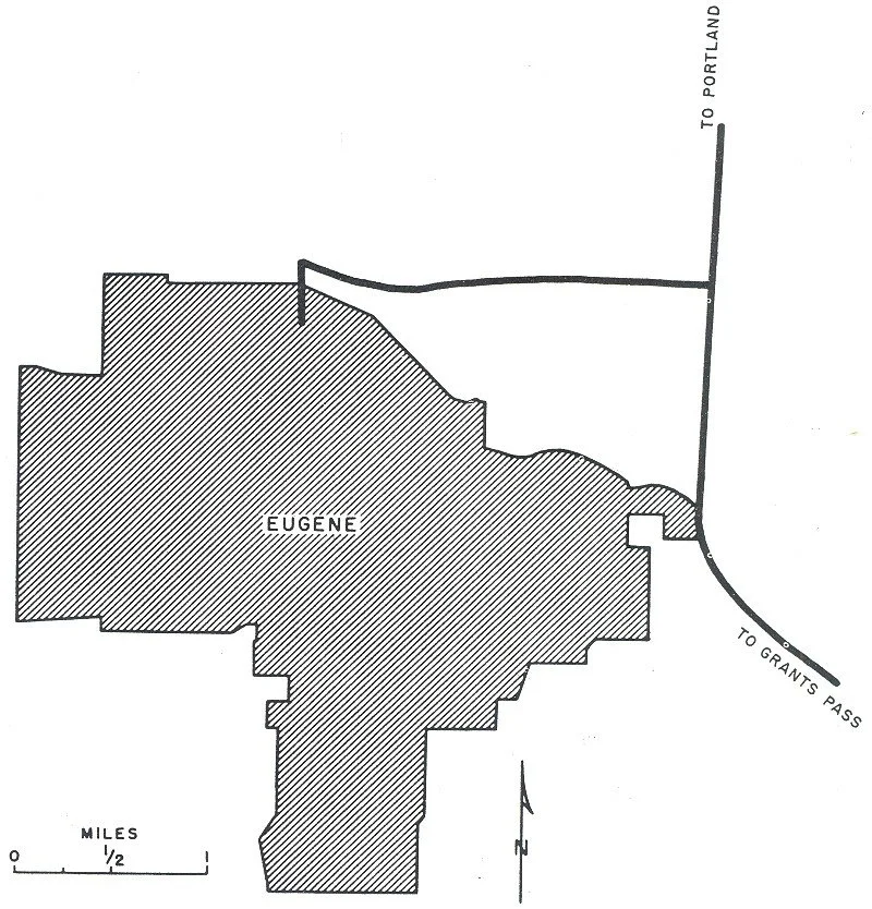

Eugene, Oregon
Archival Pigment Print, 32x40”, 2022

Eugene, Oregon
Archival Pigment Print, 32x40”, 2022
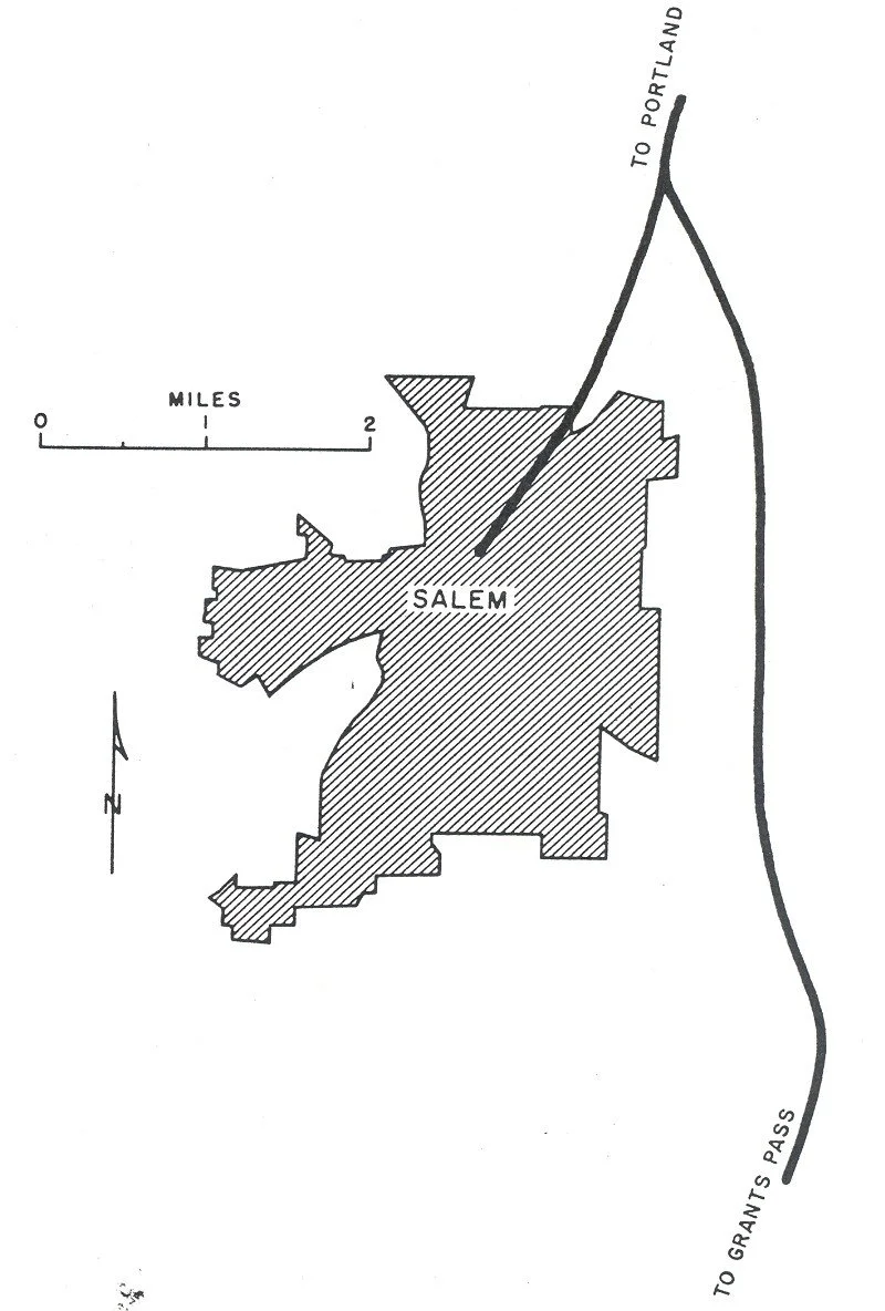

Salem, Oregon
Archival Pigment Print, 32x40”, 2022


Portland, Oregon
Archival Pigment Print, 32x40”, 2022

Portland, Oregon
Archival Pigment Print, 32x40”, 2022

Portland, Oregon
Archival Pigment Print, 32x40”, 2022

Portland, Oregon
Archival Pigment Print, 32x40”, 2022

Portland, Oregon
Archival Pigment Print, 32x40”, 2022

Portland, Oregon
Archival Pigment Print, 32x40”, 2022


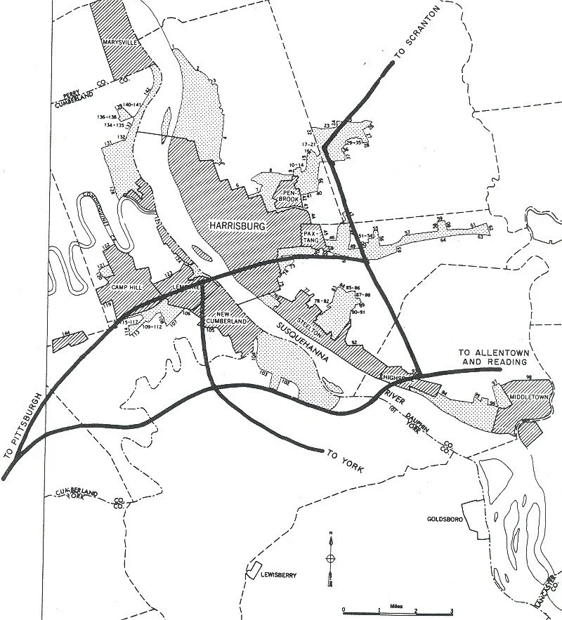
1955 Harrisburg, PA

Harrisburg, PA
Boarded up homes in Harrisburg, PA that sit underneath the interstate 83 widening projects.

Harrisburg, PA
Archival Pigment Print, 32x40”, 2021
This photograph is made in Harrisburg, VA, from a cemetery, looking out at the train tracks and elevated highway.
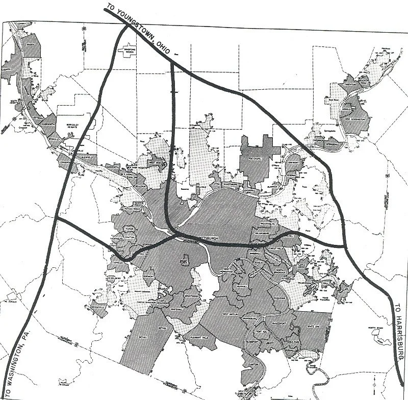

Pittsburgh, Pennsylvania
Archival Pigment Print, 32”x40”, 2022


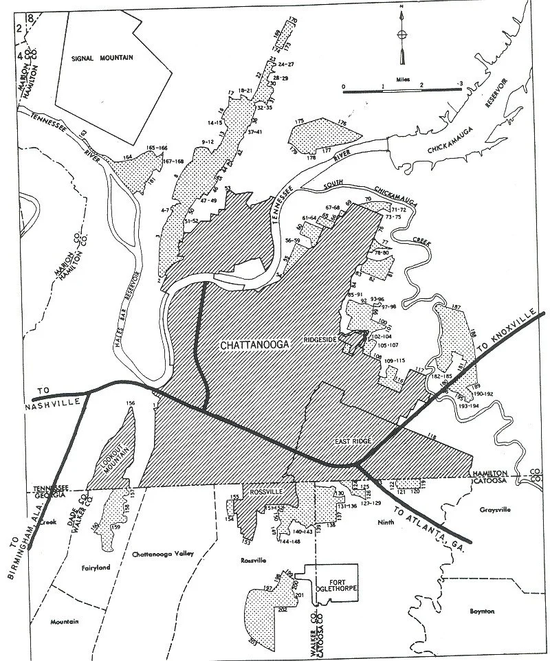
1955 Chattanooga, TN

9th Street, Chattanooga, TN
Archival Pigment Print, 32x40”, 2021
Chattanooga's 9th Street neighborhood is another example of a dynamic African American neighborhood destroyed by the highway. The Chattanooga Housing Authority called this construction the Golden Gateway Urban Renewal (or Redevelopment) Project. Over the course of the project, they evicted over 1,400 families from the corridor and destroyed more than 1,100 buildings, many of which were Black family residences and Black-owned businesses. Here I photographed from this intersection, at the Westin Hotel, with the irony of the black figure decorating their walls underneath the MLK boulevard.
https://www.arcgis.com/apps/MapSeries/index.html?appid=8dba65584072450ca8928a5f3408373f
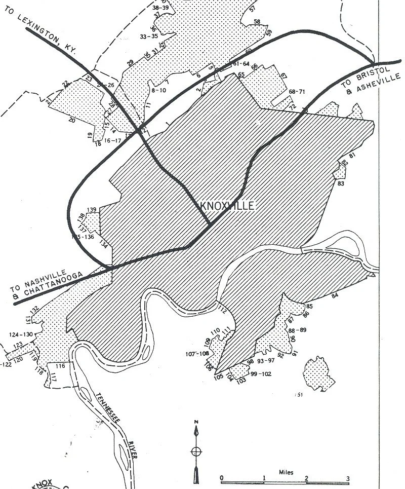
1955 Knoxville, TN

Knoxville, TN
Archival Pigment Print, 32x40”, 2021
In East Knoxville, the James White Parkway formed a physical barrier between black communities and downtown.
https://www.arcgis.com/apps/MapSeries/index.html?appid=8dba65584072450ca8928a5f3408373f
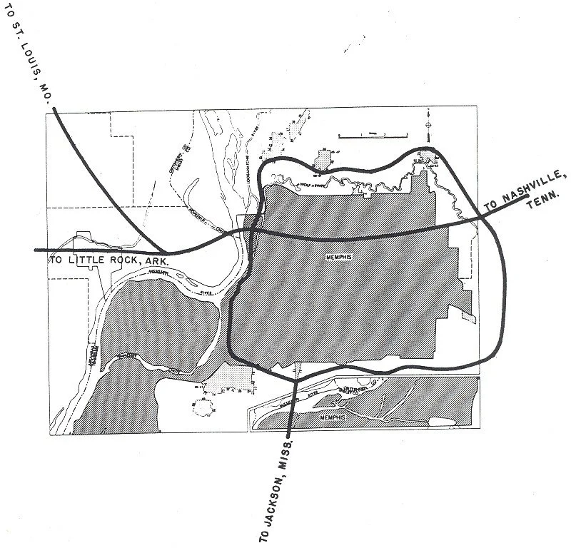
1955 Memphis, TN

Overton Park, Memphis, TN
Archival Pigment Print, 31x40”, Archival Pigment Print
In Memphis Interstate 40 was planned to be built through Overton Park. This is one of several cities that were involved in the “Highway Revolts” of the 1960s. Many revolts found more success if they argued the highway placement because of parks, rather than because of race. In Memphis, citizens were successful and stopped the interstate from being built through here.

Memphis, TN
Archival Pigment Print, 32x40”, 2021
In Memphis, one street was already razed before the change in the highway plans, with 40 homes torn down. Now, that street is being rebuilt with extravagant single-family homes and rows of condos.
https://americascanceledhighways.com/2018/06/13/see-you-in-court-memphis-and-the-fight-over-interstate-40/

1955 Nashville, TN

Edgehill, Nashville, TN
Archival Pigment Print, 32x40”, 2021
This photograph was made in the Edgehill neighborhood of Nashville. In the 1950s and 60s, Edgehill was one of the neighborhoods chosen by the interstate planning committee through which to construct I-40 and I-65. These two major arteries effectively isolated Edgehill from downtown and the east. Not only were the long-time residents of Edgehill affected by this decision but those evicted by Capitol Hill redevelopment were forced to move again just a decade later.
https://www.arcgis.com/apps/MapSeries/index.html?appid=8dba65584072450ca8928a5f3408373f

Edgehill, Nashville, TN
Archival Pigment Print, 32x40”, 2021
Edgehill was another example of a thriving black neighborhood destroyed by the highway. Today, however, with its close proximity to downtown it has become an exclusive and wealthy area, with little evidence of the people who used to call it home.In some places you can still find small original homes dwarfed by the new builds.
https://www.arcgis.com/apps/MapSeries/index.html?appid=8dba65584072450ca8928a5f3408373f
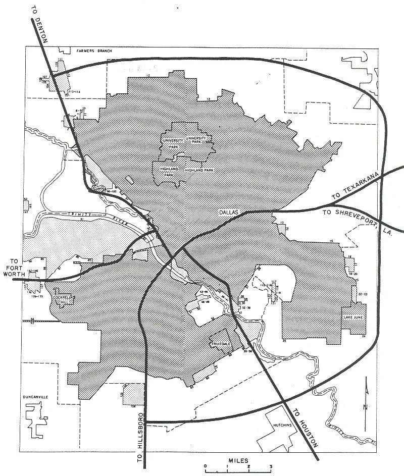
1955 Dallas, TX

Tenth Street Historic District, Dallas, TX
Archival Pigment Print, 31x40”, 2021
In Dallas, the prominent black neighborhood of Tenth Street Historic District was dissected from Oak Cliff by I-35 E. The area today suffers from blight, disinvestment, and dead-end roads.
https://www.aiadallas.org/v/columns-detail/The-Road-to-Disinvestment-How-Highways-Divided-the-City-and-Destroyed-Neighborhoods/pt/
Source: https://www.dmagazine.com/frontburner/2017/03/the-freeway-as-neighborhood-decimator/

Freedman's Cemetery, Dallas, TX
Archival Pigment Print, 32x40”, 2021
In Dallas, there is the Freedman's Cemetery, which belonged to a community of former slaves established in this area after the Civil War. In the 1930s-40s, the construction of an expressway and a major intersection eliminated most of the remaining above-ground reminders of the cemetery. In the late 1980s, efforts to expand the city's Central Expressway led members of the local community, including descendants of those buried in the cemetery, to wage a successful campaign to halt freeway construction long enough for an archeological survey and excavations of the cemetery and the relocation of those interred within it. Between 1991-94, an archeological investigation uncovered more than 1,000 graves, which were carefully relocated, and the local community constructed this memorial.
https://www.aiadallas.org/v/columns-detail/The-Road-to-Disinvestment-How-Highways-Divided-the-City-and-Destroyed-Neighborhoods/pt/
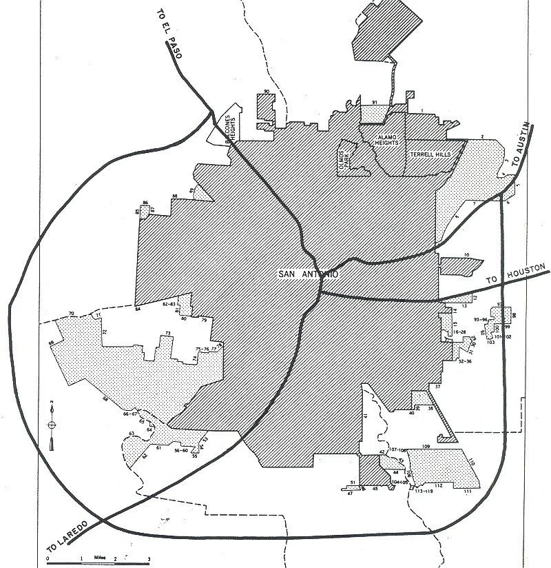

San Antonio, Texas
32x40” Archival Inkjet Print, 2022
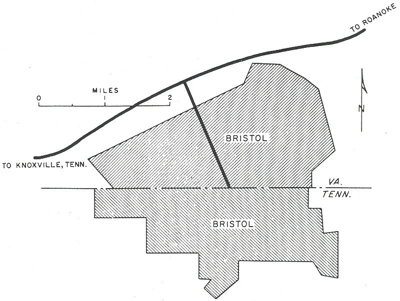
1955 Bristol, VA

Bristol, VA
Archival Pigment Print, 32x40”, 2021
Not every city included in the Yellow Book used the highway to create a racial divide, but as a comprehensive survey I would like to try and still include an image from the location, and still think about what other consequences it may have had there. This photograph was made underneath interstate 81.
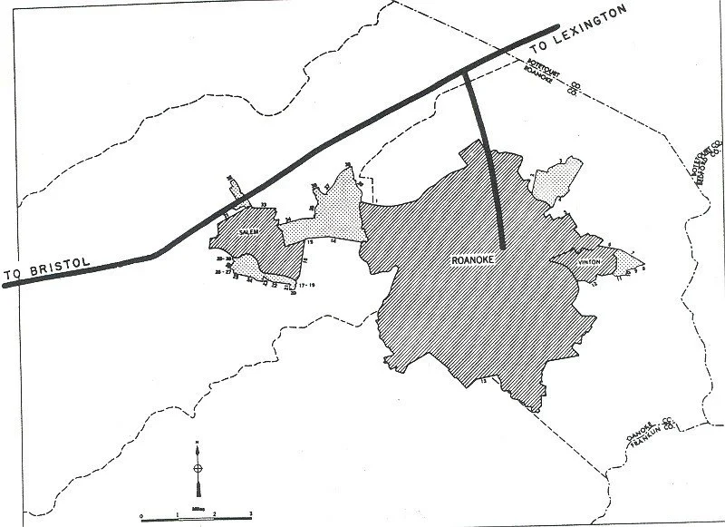
1955 Roanoke, VA

Roanoke, VA
Archival Pigment Print, 32x40”, 2021.
This photograph is from a home in a black community in Roanoke, VA. Again, the highway was used to isolate and destroy this black neighborhood. Interstate 581 sits right behind this home, on the other side, you can see a car dealership.
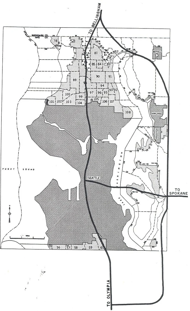

Seattle, Washington
Archival Pigment Print, 32x40”, 2022

Seattle, Washington
Archival Pigment Print, 32x40”, 2022

Seattle, Washington
Archival Pigment Print, 32x40”, 2022
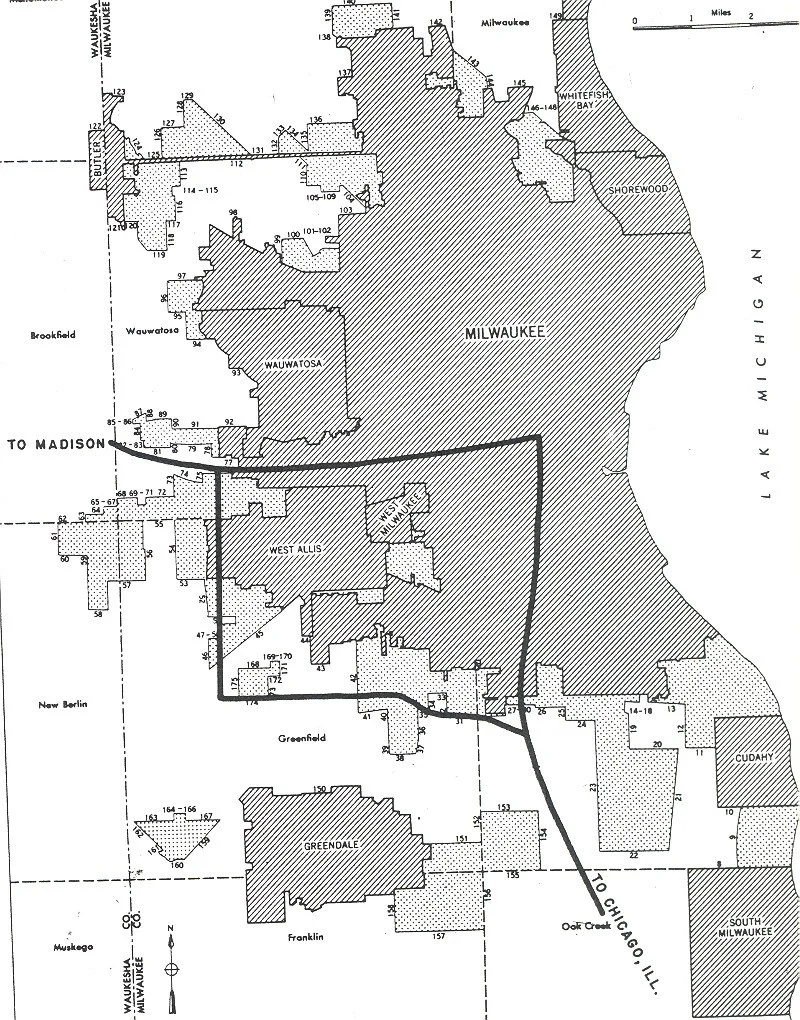

Milwaukee, Wisconsin
Archival Pigment Print, 32x40”, 2022

Milwaukee, Wisconsin
Archival Pigment Print, 32x40”, 2022

Milwaukee, Wisconsin
Archival Pigment Print, 32x40”, 2022
The Yellow Book: Interstate Legacy